Hazard Watcher
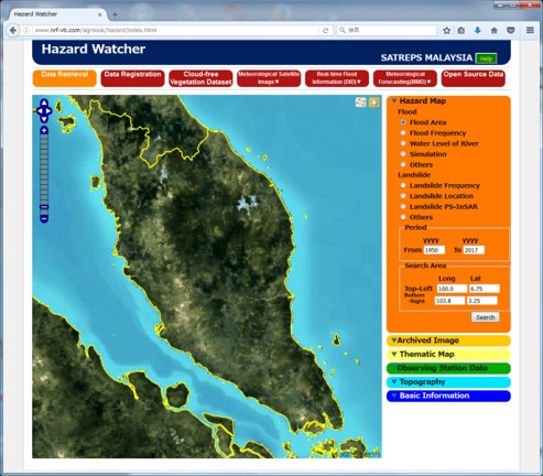
Hazard Watcher is the database which assumes space-time information utilizing
chronological order cloudfree satellite image data specialized into disasters
of floods and landslides. Hazard Watcher is web based application software
designed and capable to watch the surface hazardous places anywhere at
the designated Area Of Interest for the Disaster Monitoring/Analyzing to
prevent especially for Flood and Landslides. You can simply and easily
access to HW at any time.
The Main Menu has three major information showing archived data such as
Geospatial Information related to the Flood and Landslides.
AgriLook
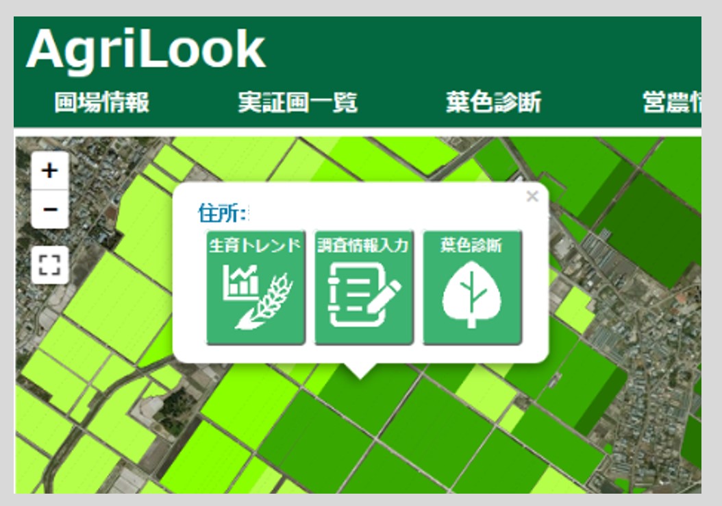
-Feasibility Survey on paddy field information management system-
Agrilook is agricultural information system with remote sensing technology. It closely tracks constantly changing crops and environments for producing high quality rice. The only tool you need is PC with Wi Fi access. On Agrilook website, a rice growth map and weather information from mesh network are available. You can also access to crop history database and update the information. Click any paddy on a map, then the crop growth rate and weather elements appear in a graph.
Providing information service
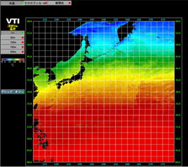
daily water temperature and distribution of chlorophyll-a
Estimate water temperature and distribution of chlorophyll a with sea surface data observed by satellite and ocean temperature measured by weather Buoy. Then, provide those information to people in fishing industry as semi live. The information is useful for more efficient fishing and monitoring ocean resources and environment.
Betweem10 and 200m depth from the surface.
Once a day. Provide water temperature of every 50m and an image of chlorophyll
a Latitude of 20 N’ 50 N’. Longitude of120 W’ 180 W’
(image of Chlorophyll a =longitude 120 W’ longitude 165 E’)
Night time images
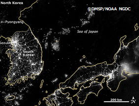
The VIIRS sensor tucked in NASA’s satellite Suomi NPP launched in 2011, captures natural/ artificial light at night by surface resolution/750m. It allows us to monitor wild fire and earthquakes in early stages. Environmental monitoring like estimation of the electricity consumption is also available. Estimating the number of fishing vessels from fishing light attractors and detecting suspicious night lights can be used for security reasons.